 » Media Center » News Releases » 2025 » March
Without traveling the globe, students in the geography program at Northwest Missouri State University have the opportunity to further their education of 1:50,000 scale topographic maps through the University’s partnership with the National Geospatial-Intelligence Agency (NGA).
Now in its third year, the partnership provides students with profession-based experience in the Geographic Information Science field while increasing NGA map production capability to meet national security challenges. Using computer software, Northwest students edit and update maps based on changes to the geologic and cultural landscape.
NGA is a premier public GIS employer that delivers world-class geospatial intelligence to assist policymakers, warfighters, intelligence professionals and first responders while enabling the U.S. intelligence community and the Department of Defense to fulfill national security priorities. Its topographic maps support worldwide combat operations, humanitarian assistance, disaster relief and military training.
Northwest is one of two universities, with Southern Illinois University, on the NGA academia partnership, which also provides internship and student employment opportunities for students studying GIScience.
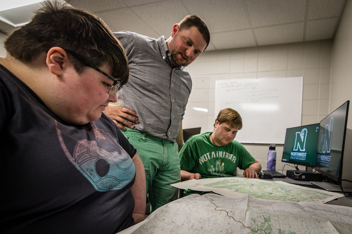
Dr. Brett Chloupek (center) looks over a pair of maps with Northwest students Nikki Welch and Joseph Sullivan, who actively edit and update topographic maps through a partnership with the National Geospatial-Intelligence Agency. (Photo by Lilly Cook/Northwest Missouri State University)
“It is the exact same work role and the exact same thing that newly hired employees at National Geospatial Intelligence would be doing,” Dr. Brett Chloupek, a Northwest associate professor of geography, said. “It’s impressive to see these students level up to the point where you can really say these are professional cartographers.”
Since the partnership began in 2022, Northwest and NGA have hired and trained 15 student cartographers to produce several hundred topographic maps for the intelligence community. Each map takes between 40 and 100 hours to complete.
Kyra Kamp, a geotechnical services analyst for Northwest, who graduated from the University last year with bachelor’s degrees in geography and geology, worked on the maps as an undergraduate student. Now, she supervises students involved with the partnership.
“The NGA partnership helped me as a student get real-world experience on actual projects before leaving school and allowed me to apply what I learned in my classes to real projects,” Kamp said. “I learned how to complete large and complex projects on a deadline. I also learned to pay attention to small details and work with specific requirements for each project. The value of this program is huge.”
To be eligible to participate in the partnership, students must have completed specific courses with satisfactory grades. The map-making process is a collaborative partnership involving students, Northwest faculty and staff, and NGA.
Nikki Welch, a senior geography major from Mexico, Missouri, has been working on NGA topographic maps at Northwest for one year. She hopes to secure employment with the company once she graduates.
“At first, I did not think I would like it but after the first couple of months, I found that I really did and loved it,” Welch said. “Also, this made me want to make a map of my own from start to finish.”
Northwest’s School of Humanities and Social Sciences offers bachelor’s and online master’s degree programs as well as an online graduate certificate program in GIScience. For more information about humanities and social science programs, visit www.nwmissouri.edu/socialsciences/programs/.


